1/8


Set out
1K+Downloads
3.5MBSize
foo(10-06-2024)
DetailsReviewsInfo
1/8
Description of Set out
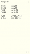
Coordinates, bearing distance, traverse, grid transformation, lines, levels, pipes, polygon.
Manage your point data in a database.
Create .csv files for upload to a total station.
View a history of your calculations in a csv file.
Set out - Version foo
(10-06-2024)What's newRemoved prompt for job name.Fixed default database job icon not showing.
Set out - APK Information
APK Version: fooPackage: tools.surveyingName: Set outSize: 3.5 MBDownloads: 0Version : fooRelease Date: 2024-06-10 11:35:46Min Screen: SMALLSupported CPU:
Package ID: tools.surveyingSHA1 Signature: 40:45:8C:58:C1:96:6A:60:16:71:39:1B:C5:36:24:BE:D4:F8:2D:42Developer (CN): Sope ConsultingOrganization (O): sopeconsultingLocal (L): LondonCountry (C): GBState/City (ST): LondonPackage ID: tools.surveyingSHA1 Signature: 40:45:8C:58:C1:96:6A:60:16:71:39:1B:C5:36:24:BE:D4:F8:2D:42Developer (CN): Sope ConsultingOrganization (O): sopeconsultingLocal (L): LondonCountry (C): GBState/City (ST): London


Apps in the same category

You may also like...


English


